FISHING BRIEF
Monday July 27, 2026 // Mouse Island, Lake Erie Western Basin
Still GO, but the window is closing faster than the 9:15 edition read it. Buoy 45005's 9:30 AM row reads a WSW wind of 13.6 kt gusting 15.6, up another two knots in the last fifty minutes and now at the top of the comfortable band rather than inside it. A fresh LEZ143 issued at 9:19 AM still calls west 5 to 15 kt becoming southwest with waves 1 foot or less all day, and waves, not wind speed, are the number that governs a PWC. But the trend is one direction and it is worth respecting: 9.7 kt at 8:30, 11.7 at 8:40, 13.6 at 9:30. The board is clean: no Small Craft Advisory, no hazard banner on the Ottawa County point forecast, an empty alerts array in live.json. Water is up to 76.3°F, the warmest reading of the month. Southwest is the lee quadrant at Catawba, which is the friendliest wind direction this brief ever gets to report. The reason to go today is what happens next. Tonight the wind climbs to SW 15-20 kt with showers and thunderstorms and a half to three quarters of an inch of rain. Tuesday it swings NW 15-20 kt becoming north, waves 1-3 ft building to 2-4 ft, which is a textbook Western Basin NO-GO on the jet ski: north quadrant, over 15 knots, over shallow water. So today is not one good day among several. It is the last one for a while. Two honest asterisks. First, the wave number is an estimate again: buoy 45005's WVHT channel has read MM on 83 straight rows, every observation since 7:50 PM last night, now nearly fourteen hours, so the 1 ft figure comes from wind trend plus LEZ143, not a measurement. That matters more at 13.6 kt than it did at 11.7. Mouse Island Reef at 1.2 nm is your instrument, and today it is worth actually using rather than reading past. Second, the morning shower band has now passed and the sky is the clean part of the day, but a slight chance of thunderstorms late remains. Fish now through early afternoon and do not stretch it. Intel is thin and pointing one direction: perch. The three newest threads on community.walleye.com are all perch, including a 30-fish limit on 7/24, and the standing regional read has the Western Basin as perch central from mid-July through October with the reefs north of Catawba named specifically. Walleye stays east and deeper, helped by the lowest barometer of the month at 1011.5 hPa ahead of tonight's front. Because the storms are late and the runs should be short, the whole top three sits inside 5 nm of the ramp today.
W 82° 49.962'
W 82° 51.600'
W 82° 45.000'
⬇ DOWNLOAD ALL 10 WAYPOINTS (.GPX)
Full list (launch + 9 fishing spots) in section 03 below.
01Jet-Ski Call — still GO, but the window is tightening NWS LEZ143 (issued 9:19 AM) + buoy 45005 pulled 10:02 AM ET 7/27 · live data on refresh
Nothing on the board argues against launching, and the board is verified clean. A direct query to the NWS alerts API returns zero active products for both Ottawa County (OHZ007) and marine zone LEZ143: no Small Craft Advisory, no Special Weather Statement, no dense fog advisory, no thunderstorm watch. The live conditions feed agrees with an empty alerts array. The one item in effect is a routine Hazardous Weather Outlook, a daily bulletin rather than an advisory.
The change since the 9:15 edition is the wind, and it is going one way. Buoy 45005's 9:30 AM observation reads WSW 13.6 kt gusting 15.6, up from 11.7 gusting 13.6 fifty minutes earlier and 9.7 an hour before that. That puts sustained wind at the top of the 10-15 kt caution band and gusts brushing 15.6. A fresh LEZ143 issued at 9:19 AM still holds the day at west 5 to 15 kt becoming southwest, waves 1 ft or less. The call stays GO because waves govern a PWC, not raw wind speed, and 1 ft out of the lee quadrant is genuinely fine water. But the practical turnaround just moved earlier. The water you launch into now is the calmest you will see for the rest of the day.
Direction is still the best part of today. West-southwest is the lee quadrant at Catawba. The land sits upwind, fetch at the launch is close to nothing, and the shallow north reefs, the ones that turn ugly on a north wind, are protected. Water holds at 76.3°F, the warmest of the month, and the barometer is 1011.4 hPa with the tendency easing to +0.3 from +0.7 three hours ago, still the lowest absolute pressure this brief has reported in weeks. That is a pre-frontal signature, and it is good for the bite.
The clock is the constraint, not the water. Tonight the wind goes SW 15-20 kt with showers and thunderstorms and 100 percent precip. Tuesday it swings NW 15-20 kt becoming north with waves 1-3 ft building to 2-4 ft, which is a straight NO-GO on the Fish Pro: north quadrant, over 15 knots, over shallow water. There is also a slight chance of thunderstorms late today. If you are reading this at the 10 AM refresh, sunrise is four hours gone and the useful part of the day is now through early afternoon. Work it, read the western sky, and be on the trailer before building cumulus turns into anything. A cell that is an inconvenience in a boat with a cabin is a different problem entirely on a PWC.
Launch Catawba Point. Bail-out harbors: Catawba, Port Clinton, Put-in-Bay, Kelleys.
02What's Biting community.walleye.com + lakeeriefish.com + ODNR 7/17 · pulled 9:14 AM ET 7/27, unchanged at 10:02
- Perch — this is the ascending bite and it is the story of the week. The three newest threads on community.walleye.com are all perch: "Perch are starting" and "Perch" both posted 7/25, and "Perch limit at Huron" on 7/24 reporting 30 fish, which is the full West Zone daily limit. Huron and Lorain are the Central Basin edge so the exact spots do not transfer, but the timing signal does. The standing regional read backs it up and is specific about our water: the Western Basin between Toledo and the islands is perch central from mid-July through October, with the reefs north of Catawba Island named directly as key water. ODNR's last filed report noted perch starting south of Green Island, which is why that water is at RANK 02 today. Target 16-24 FOW, two-hook spreader, emerald shiners, straight down on any school you mark. West Zone limit is 30 per angler.
- Walleye — still east and deeper, and today the barometer is on your side. ODNR's official Lake Erie report (still filed 7/17/26, no newer edition, direct URL 404s again) puts Western Basin success east of the reef complex and near Kelleys Island, drifting, casting, or trolling in 23-30 FOW with lures running 15-30 ft down, keepers averaging 16-22″. The July regional reports have fish continuing to push east out of the western basin behind the mid-June mayfly hatch, with worm harnesses and crankbaits doing the work and averages of 18-23″. Closer to home the standing Port Clinton pattern holds: 18-26 FOW worked 4-8 ft off the bottom on drifted or cast harnesses at F Can, Clinton Reef, and the Catawba-to-Marblehead corridor. The genuinely new variable is pressure. The barometer sits at 1011.5 hPa, the lowest of the month and roughly 6-10 hPa under the settled high that parked over the basin last week, with a front arriving tonight. Pre-frontal low pressure is the best walleye window this brief has reported in two weeks. Fish the top of every speed range.
- Smallmouth bass: Prime at 76.3°F, holding on rocky points and reef edges around the Bass Islands. Tubes, drop-shot, jerkbaits. At 13.6 kt the natural drift on a point is workable but brisk, so plan on the trolling motor to hold position rather than assuming you can free-drift it.
- White bass: Summer blitzes possible any day at this temperature, and pre-frontal pressure makes surface activity more likely than usual. Keep a small spoon rigged for boils.
02bRecent Angler Reports (Facebook) loading...
02cWater Clarity (NASA MODIS satellite) NASA Worldview · 250 m/pixel · today's pass
Two satellites pass over Lake Erie daily. Use these to spot sediment plumes (muddy west end from Maumee River runoff), algae blooms (green/turquoise patches), and clearer water (deep blue). Walleye prefer stained but not muddy water — pick areas where the plume is fading into clearer blue.
TERRA · ~10:30 AM EDT pass · click for interactive
AQUA · ~1:30 PM EDT pass · click for interactive
If clouded over, step back a day in the Worldview interactive viewer.
03Where to Go (full list) static for the day
Settings » Communications » ActiveCaptain), pair.On the water: open
reel.quest/today → tap DOWNLOAD GPX → iOS share sheet → ActiveCaptain → waypoints sync wirelessly.
Read the list in two halves today. Spots 2 through 4 are all inside 5 nm and are what this brief actually recommends, because the storm risk is late and short legs home are worth more than distance. Spots 5 through 10 are genuinely fishable on today's SW wind and are here for a dawn start, not an afternoon decision.
- Catawba Point Association ramp (launch). [LOW] Your home ramp. Drop a pin at actual ramp and tell me — I'll re-deploy.
> N 41° 35.280', W 82° 50.400' 📍 Open in Maps - Mouse Island REEF. [HIGH — Natural Atlas] Actual fishing structure, NOT the island. ~1.2 nm NNE of launch. Limestone shoal, 0.33 sq mi, least depth 9 ft. RANK 01 today, and it has two jobs. First it is your wave gauge: the buoy's WVHT channel is dark, so look at this water before committing to distance. Second it is perch water in the 16-24 FOW band, and the regional read names the reefs north of Catawba directly. For walleye work the 14-22 ft perimeter at 1.5-1.7 mph to find pods and jig back through.
> N 41° 36.402', W 82° 49.962' 📍 Open in Maps - South of Green Island. [MED — derived from ODNR report] ~3.3 nm NNW, 16-24 FOW. RANK 02 today. ODNR's last filed report has yellow perch starting south of Green Island, and perch is the bite that is going up this week. This water also sits protected on a WSW wind, with the islands and the Catawba shore upwind, so the drift stays civilized. Idle the 16-24 ft contour watching the finder, and when you mark a school stop and park on it rather than trolling through. Coord is derived from a descriptive report, so treat it as a search start, not a pin.
> N 41° 38.400', W 82° 51.600' 📍 Open in Maps - East of the reef complex / Kelleys west approach. [MED — derived from ODNR 7/17 report] ~4.6 nm ENE, 23-30 FOW. RANK 03 today, and the farthest this brief ranks. ODNR puts Western Basin success east of the reef complex and near Kelleys Island, drifting, casting, or trolling with lures running 15-30 ft down, keepers averaging 16-22″. Use a Jet Diver or bottom bouncer to reach the band. Best place on the list to run the in-line boards: open water, room to spread, and it is a Monday, so the Saturday traffic argument is gone. Deploy early, the wind builds through the afternoon. Coord is derived from a descriptive report, so hunt the 23-30 ft contour on the finder rather than trusting the pin.
> N 41° 37.500', W 82° 45.000' 📍 Open in Maps - Marblehead current zone / Catawba-to-Marblehead corridor. [MED] Pin is ~6.7 nm ESE at the Marblehead end; the corridor itself starts about 3 nm out, so you can begin working it early and stay close to home. Port Clinton reports name the water between Catawba and Marblehead in 18-26 FOW as a current producer, fish taken drifting or casting worm harnesses 4-8 ft off the bottom, keepers mostly 15-22″. At 13.6 kt the natural drift is now faster than you want, so check SOG and plan on the trolling motor to hold 1.2-1.3 mph. Verify the actual current break with the fish finder.
> N 41° 32.400', W 82° 42.300' 📍 Open in Maps - Round Reef. [HIGH — Coe Vanna Charters] ~6.8 nm W, right next to Niagara. Jigging water, 10-16 FOW. Fish it and Niagara as a single complex on one trip out. Dawn start only today.
> N 41° 37.040', W 82° 59.150' 📍 Open in Maps - Niagara Reef (buoy 5). [HIGH — Coe Vanna Charters] ~7.5 nm WNW of launch. Lighted buoy marks the reef. Best structure in range, and unlike Saturday it is a Monday, so you get real elbow room. Troll the 18-22 ft edges at 1.5-1.7 mph or jig the rocky outskirts. Dawn start only today — that is a 25-minute run home if a cell builds.
> N 41° 39.840', W 82° 58.390' 📍 Open in Maps - Toussaint Reef. [HIGH — Coe Vanna Charters] ~8.2 nm W. Named for jigging the rocky outskirts. Sees a fraction of Niagara's pressure. Pairs with Little Pickerel 1.5 nm to the north, so the two are one trip out. Eight miles is a real commitment on any day and a questionable one on a day with late storm risk: watch fuel, hit REFRESH before committing, turn back if the sky changes.
> N 41° 36.660', W 83° 01.240' 📍 Open in Maps - Crib Reef (buoy 7). [HIGH — Coe Vanna Charters] ~8.6 nm NE. Buoy 7 marks it. The northeast alternative if you would rather not run west. Watch fuel and the clock.
> N 41° 38.820', W 82° 39.990' 📍 Open in Maps - Little Pickerel Reef. [HIGH — Coe Vanna Charters] ~9.5 nm WNW. Named perch water, limit catches in 16-24 FOW, alongside Crane Creek, Toledo Light, A Can, and the Toledo Water Intake. Mark a school, park on it, drop a two-hook spreader with emerald shiners. Longest run on the list. On a day with thunderstorms forecast late, this is a dawn-departure-only spot — and the Green Island water at 3.3 nm fishes the same program.
> N 41° 40.150', W 83° 01.290' 📍 Open in Maps
04What to Throw verified product links
Water is 76.3°F, the warmest of the month, and the two programs are unchanged: a perch spreader in 16-24 FOW, which is the ascending bite and the one the freshest intel actually names, and a weighted worm harness for walleye in 18-26 FOW worked 4-8 ft off the bottom close in, or 23-30 FOW east of the reef complex with lures 15-30 ft down. The adjustment today is the barometer. At 1011.5 hPa this is the lowest pressure of the month with a front arriving tonight. Pre-frontal low pressure generally means a fish more willing to chase, so fish the top of every speed range, not the bottom, and cover water early rather than grinding one spot. The second adjustment is the calendar. It is a Monday, so the traffic argument that kept the in-line boards off a crowded reef on Saturday is gone. The boards are on. Just deploy them early, because the wind builds through the afternoon and boards get harder to manage solo as it does.
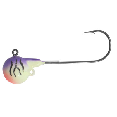
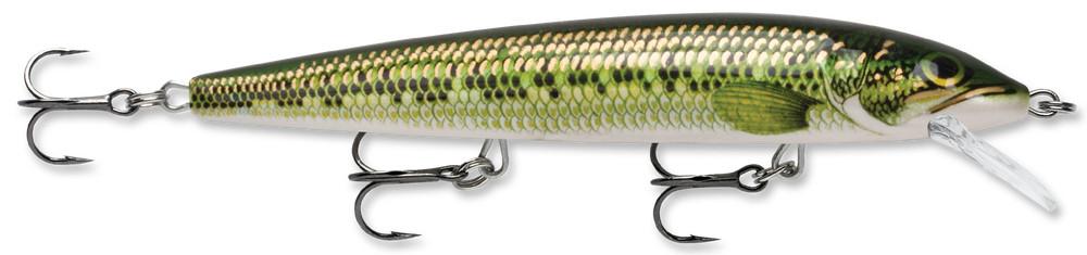
The whole game is putting baits at the right depth and speed and covering water until you find a pod, then working back through it slowly. Rig C, the weighted harness, is still the walleye headline. Today's two twists are speed (lean fast, the barometer is the lowest of the month) and timing (deploy the spread early, the wind builds all afternoon).
Full how-to: Worm harness · In-line boards · Short-line trolling
05Beginner Notes
- Today is the closing window, so plan backwards from the weather instead of forwards from the fish. Tonight brings SW 15-20 kt with thunderstorms and up to three quarters of an inch of rain, and Tuesday is a hard NO-GO at NW-to-N 15-20 kt with waves building to 2-4 ft. Sunrise (6:19 AM) is already behind you at this refresh, so the honest plan is launch now, fish through early afternoon, and set yourself a turnaround time before you leave the ramp. The temptation on a last-good-day is to squeeze the afternoon. That is exactly the day not to, and the wind climbing four knots since dawn is the argument.
- The wave number is an estimate again, not a reading, and the wind under it has doubled. Buoy 45005's wave sensor has been dark for nearly fourteen hours, 83 straight rows of MM, and wind has gone from 6 kt to 13.6 kt since that last real measurement. LEZ143 still calls 1 ft or less and the lee-quadrant direction supports it, but this is the exact setup where an estimate quietly drifts. Stop at Mouse Island Reef, 1.2 nm out, and look at the water yourself before you commit to anything longer. An estimate is not an observation.
- One safety note: the heat index reaches 96°F today and a PWC gives you no shade at all, so carry more water than you think you need. File a float plan with Jen (where, when back), keep the kill-switch lanyard clipped to your PFD, and remember Ohio's sunrise-to-sunset PWC rule (sunrise 6:19 AM, sunset 8:56 PM). Watch the western sky for building cumulus all afternoon and hit REFRESH before committing to any long run. DDM coords only; the .GPX loads all 10 waypoints to the ECHOMAP.
06Sources Pulled conditions re-fetched 10:02 AM ET 7/27 · fishing intel carried from 9:14 AM pull
- NWS LEZ143 nearshore (fresh issuance 9:19 AM EDT 7/27, pulled 10:02 AM, superseding the 3:36 AM product the earlier editions used): no Small Craft Advisory, no headline warning. A routine Hazardous Weather Outlook is in effect, which is a daily outlook bulletin rather than an advisory. Rest of today west 5-15 kt becoming southwest (the earlier issuance said SW throughout), a slight chance of showers late this morning, a slight chance of showers and thunderstorms late, waves 1 ft or less. Tonight SW 5-15 kt increasing to 15-20 kt, showers with a chance of thunderstorms, waves 2 ft or less. Tuesday NW 15-20 kt becoming north, partly sunny, waves 1-3 ft building to 2-4 ft. Tuesday night N 15-20 kt, 2-4 ft. Zone water temps: Toledo 77°F, Cleveland 73°F, Erie 75°F.
- NWS active-alerts API (queried directly 10:02 AM ET, a stronger check than scraping the hazard banner):
api.weather.gov/alerts/activereturns zero features for Ottawa County OHZ007 and zero features for marine zone LEZ143. No dense fog advisory, no Special Weather Statement, no thunderstorm watch, no Small Craft Advisory. The morning fog/mist noted at Toledo Executive at 6:53 AM never reached advisory threshold and has cleared; the shower band that carried a slight chance before 10 AM at 20% has now passed. Today partly sunny, high near 89°F with a heat index to 96°F, SW 5-10 mph, 30% precip. Tonight showers and thunderstorms mainly before 2 AM, low around 70°F, SW 8-11 mph, 100% precip, 0.5-0.75 in. Tuesday chance of showers and thunderstorms before 8 AM, partly sunny, high near 82°F, north wind 15-17 mph. - reel.quest/live.json (cron-generated 10:00 AM ET): alerts array still empty, a third independent cross-confirmation that no watch, warning, or advisory is in effect for the launch point. Catawba point forecast high 85°F, SW 9-13 mph, "slight chance of rain showers before 10am, then mostly sunny." Tonight SW 12-17 mph, 100% precip. Tuesday NW 18-23 mph, Tuesday night N 23 mph. Buoy block reports
water_temp_f: 76.3,wind_speed_kt: 13.6at 250°, andwave_height_ft: null— the feed correctly emits null rather than carrying forward a stale wave number, and it now agrees with this brief's raw-row wind exactly. - Buoy 45005 (raw NDBC realtime2, latest row 9:30 AM ET 7/27): water 76.3°F (24.6°C, flat across the whole morning), air 75.6°F, wind 13.6 kt from 250° (WSW), gusts 15.6 kt. That is up from 11.7 gusting 13.6 at 8:40 and 9.7 at 8:30, so the wind has climbed steadily all morning and now sits at the top of the 10-15 kt caution band. Barometer 1011.4 hPa, tendency easing to +0.3 from +0.7, still the lowest absolute pressure of the month. WVHT is dark: 83 consecutive rows read
MM, every observation since 7:50 PM EDT 7/26, nearly fourteen hours. The last valid wave height is 0.1 m (~0.3 ft) at 7:50 PM 7/26 on a light 6 kt southerly. The ~1 ft figure in this brief is an estimate derived from the wind trend plus LEZ143's independent call, not a measurement, and the wind beneath it has more than doubled since that last reading. It is labeled EST on the stat tile. - community.walleye.com Western Basin (pulled 7:45 AM ET): index served, and this is the freshest intel of the run. The three newest threads are all perch: "Perch are starting" (7/25), "Perch" (7/25), and "Perch limit at Huron" (7/24, 30 fish). Also "Lorain 7/25" and a "Looking for tips" walleye thread from 7/24 with 8 replies. Huron and Lorain are the Central Basin edge, so the specific locations do not transfer, but the timing signal does. A first attempt at this source returned ECONNRESET; the retry served.
- Regional July 2026 reports (web search, pulled 7:45 AM ET): the Western Basin between Toledo and the islands is perch central from mid-July through October, with the reefs north of Catawba Island named as key water. Walleye continue pushing east behind the mid-June mayfly hatch, worm harnesses and crankbaits doing the work, averages 18-23″. West Zone daily limits confirmed at 6 walleye, 30 perch.
- ODNR official Lake Erie report (last filed 7/17/26, no newer edition; the direct URL returned HTTP 404 again and content was reached indirectly): Western Basin success east of the reef complex and near Kelleys Island, drifting/casting/trolling in 23-30 FOW with lures at 15-30 ft down. Keepers averaging 16-22″. Yellow perch starting south of Green Island, which is the RANK 02 spot today.
- lakeeriefish.com Western Basin subpage SKIPPED as STALE: the page served fine, but its content is still a spring report — "off to a slow start," "the water still needs to warm up a degree or two." Not applicable at 76.3°F. Re-checked at 9:14 AM and confirmed from the page's own metadata:
datePublished2024-03-13,dateModified2025-02-08. This is an evergreen landing page, not a dated weekly report, so nothing on it should ever be read as this week's intel. Its standing numbers (19-28 FOW, bottom 5-6 ft, 1-1.8 mph on Reef Runners / Husky Jerks / P10s, high-current areas at Mouse Island, Middle Bass, Marblehead) are carried as background only, not as current intel. - lakeeriefish.com July 2026 walleye report SKIPPED for Western Basin purposes: served, but this edition covers the Central Basin (Lorain, 47-52 ft, spoons on downriggers at 2.7-3.0 mph) and Eastern Basin (55-60 ft, dipsies and leadcore). It says only that walleye "push east" out of the western basin and gives no Western Basin specifics.
- Coe Vanna Charters report page SKIPPED: served, most recent entry is still April 10, 2026. Its reef coordinate list remains the source for every [HIGH] waypoint in this brief.
- fishingbooker.com Port Clinton reports SKIPPED: HTTP 403 Forbidden.
- sirwalleyecharters.com reports SKIPPED: request timed out at 60 seconds.
- Lake Erie Walleye Trail: not re-pulled this run. No new Western Basin event has surfaced in the last 30 days across prior runs.
- FB groups PAUSED: account security checkpoint, pending Rob. No FB scrape this run.
Full technique library. Each is a standalone page with setup, presentation, what a strike feels like, the one mistake to avoid, and "Further reading" links. Today's brief runs two programs: a perch spreader in 16-24 FOW, which is the bite that is climbing this week and the one the freshest intel names, and a weighted worm-harness troll for walleye in the deeper eastern water. In-line boards are back on — Saturday's traffic argument is gone on a Monday — but deploy them early, because the wind builds all afternoon toward tonight's front. Reading the fish finder is the skill that matters most today, since finding a perch school is the whole game.
This is a refresher, not a class. Reread it the night before a trip. You're running a low-freeboard PWC on the shallowest, rockiest, most weather-volatile basin of the Great Lakes, sharing water with 700-foot freighters and weekend pontoon traffic. Three things will keep you alive and legal: respect the reefs, know who has right of way, and follow Ohio's PWC rules. Everything below is built around those three.
ALake Erie Western Basin: PWC operating envelope
The Western Basin is the shallowest part of Lake Erie. Average depth around 24 feet, with reef shelves at 1 to 4 feet that aren't always buoyed. Wind builds chop fast because there's nothing for waves to do but stack. A Fish Pro Trophy sits low. You feel weather sooner than a 22-foot center console does.
Yellow light: winds 10 to 15 kt, waves 1 to 2 feet. Doable if you stay west of the islands and inside known water. Plan a short loop.
Red light: winds 15+ kt sustained, waves 2+ feet, or any T-storm risk. Stay on the trailer. The Western Basin builds 3 to 5 foot square chop fast, and a PWC takes those waves like a brick. NOAA marine forecast for LEZ143 is the call, not the lakeshore forecast.
BUSCG navigation rules: right of way
The Navigation Rules (COLREGS and US Inland Rules) treat every encounter as one boat being the stand-on vessel (holds course and speed) and the other being the give-way vessel (alters course or speed to avoid). PWCs are power-driven vessels under the rules, so the same rules apply to you as to any motorboat. But you also have practical obligations because you're small, fast, and harder to see.
COhio PWC regulations (Ohio DNR Division of Parks & Watercraft)
12 to 15: can operate a PWC only with a Boater Education Certificate AND an adult (18+) physically on board.
Under 12: cannot operate a PWC, period. Can ride as passenger.
DTrip-day mental checklist
Read this in the truck before backing down the ramp.